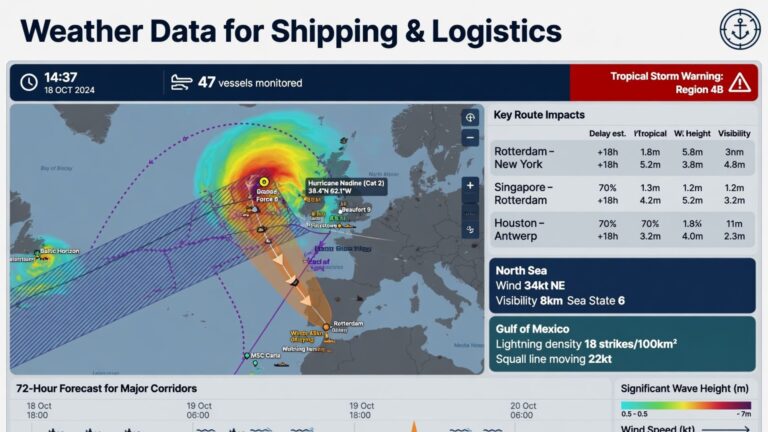
Global maritime logistics operates on tight schedules and razor-thin profit margins. Consequently, environmental conditions heavily dictate operational efficiency and safety at sea. To navigate these variables, shipowners and operators rely heavily on shipping weather data to make informed decisions. This specialized information provides real-time and predictive meteorological insights tailored specifically for maritime routes. Furthermore, it enables vessels to avoid severe storms and optimize their speed for fuel efficiency. Therefore, accurate meteorological data serves as a critical navigational tool rather than a mere convenience.
The Role of shipping weather data in Maritime Operations
Modern vessels traverse some of the most unforgiving environments on Earth. Captains need precise information to protect the crew, cargo, and the vessel itself. Shipping weather data delivers this necessary insight by translating complex meteorological phenomena into actionable navigation charts. Furthermore, this data integrates directly into the ship’s Electronic Chart Display and Information System (ECDIS). Consequently, officers on the bridge can visualize approaching weather systems alongside their planned route.
Enhancing Navigational Safety and Risk Mitigation
Severe weather causes a significant percentage of maritime accidents. High winds, rogue waves, and dense fog endanger vessels and their cargo. By analyzing shipping weather data, crews can alter their course days in advance to avoid these hazards. For instance, if a severe tropical cyclone develops ahead, the routing software suggests an alternate path. Therefore, proactive risk mitigation prevents structural damage to the ship and ensures crew safety. Additionally, avoiding heavy seas minimizes cargo shifting, which remains a leading cause of logistical losses.
How shipping weather data is Collected and Processed
Generating accurate marine forecasts requires a massive, global data-gathering infrastructure. Meteorologists cannot rely on land-based radar systems alone. Instead, they pull information from a vast network of oceanic sensors and satellites. Consequently, the data collection process operates continuously to provide up-to-the-minute accuracy.
Satellite Oceanography and Buoy Networks
Weather satellites orbiting the Earth provide the foundation for marine forecasting. They measure sea surface temperatures, wave heights, and wind speeds across vast ocean expanses. Furthermore, networks of automated ocean buoys complement satellite readings. These buoys record localized atmospheric pressure and current directions. Ships themselves also contribute to this network by transmitting automated weather observations as they transit. Therefore, this multi-source approach ensures a highly accurate and comprehensive meteorological picture.
Predictive Weather Modeling and AI Integration
Raw data means little without sophisticated processing. Meteorological agencies feed this oceanic data into complex supercomputer models. These models simulate atmospheric conditions to predict future weather patterns. Recently, artificial intelligence has enhanced these predictive models significantly. AI algorithms analyze historical weather outcomes to refine future forecasts. Consequently, AI-driven shipping weather data provides highly accurate predictions up to two weeks in advance. This extended forecast window allows ship operators to plan long voyages with greater confidence.
Optimizing Voyage Routing with shipping weather data
Route optimization goes beyond simply avoiding storms. It involves finding the most efficient path considering wind, waves, and ocean currents. A ship sailing directly into strong headwinds burns significantly more fuel and arrives late. Conversely, a slightly longer route utilizing favorable currents can save time and money. Therefore, sophisticated routing software utilizes shipping weather data to calculate the optimal speed and heading.
Fuel Efficiency and Emissions Reduction
Fuel represents the largest operational expense for maritime shipping companies. Furthermore, international regulations require ships to reduce their carbon emissions significantly. By leveraging shipping weather data, captains can adjust their engine loads to match environmental conditions. If favorable currents push the vessel, the crew can reduce engine power without losing speed. Consequently, this practice drastically lowers fuel consumption. It also ensures compliance with strict environmental standards set by the International Maritime Organization (IMO). Thus, weather routing directly supports sustainable maritime operations.
The Economic Impact of shipping weather data
The financial implications of weather routing extend across the entire supply chain. Arriving late to a port incurs massive demurrage fees and disrupts onward connections. Furthermore, encountering heavy weather often results in physical damage that requires expensive repairs. By utilizing accurate forecasts, shipping companies protect their profit margins and maintain schedule reliability.
Reducing Delays and Insurance Premiums
Consistent on-time arrivals build trust with cargo owners. When ships avoid weather delays, the entire logistics chain functions smoothly. Furthermore, insurance companies recognize the value of weather routing. Vessels that utilize professional weather routing services often qualify for lower hull and machinery insurance premiums. Insurers understand that these ships face a statistically lower risk of catastrophic weather damage. Therefore, investing in high-quality meteorological data yields tangible financial returns through reduced insurance costs and avoided port fees.
Challenges in Delivering Accurate shipping weather data
Despite technological advancements, delivering weather data to ships presents unique challenges. The ocean remains a harsh environment for electronic sensors. Furthermore, communicating massive datasets to vessels in the middle of the ocean requires specialized connectivity.
Bandwidth Limitations at Sea
While satellite internet has improved, bandwidth remains expensive and limited on many commercial vessels. Transmitting high-resolution weather models requires significant data capacity. If a ship experiences a connectivity drop, the crew might lose access to real-time updates. Consequently, weather service providers must compress data efficiently without losing vital meteorological detail. They often provide specialized, low-bandwidth text summaries alongside graphical interfaces. Therefore, optimizing data transmission ensures that ships receive critical updates even in remote oceanic regions.
Future Trends in Maritime Weather Technology
The integration of weather data into maritime operations continues to evolve. The industry moves rapidly toward autonomous shipping and enhanced digitalization. These advancements require even more precise and localized meteorological data. Future systems will likely feature continuous, automated adjustments to ship navigation based on live weather feeds. Furthermore, drone technology offers a new frontier in marine meteorology. Ships could deploy weather drones to assess localized conditions directly ahead of their path. Consequently, this hyper-local data will fill the gaps left by satellite and buoy networks.
Top 6 SEO-Optimized FAQs
1. What is shipping weather data?
It is specialized meteorological and oceanographic information used by maritime operators to plan safe and efficient vessel routes.
2. How does weather routing save fuel?
By identifying favorable currents and avoiding heavy headwinds, ships can reduce engine load without losing speed, significantly cutting fuel consumption.
3. Can shipping weather data prevent maritime accidents?
Yes, it allows captains to alter course and avoid severe storms, high winds, and rogue waves that could damage the vessel or cargo.
4. How is ocean weather data collected?
Data is gathered through a combination of orbiting weather satellites, automated ocean buoys, and observations transmitted by ships at sea.
5. Does weather routing affect insurance premiums?
Yes, insurers often offer lower premiums to vessels that use professional weather routing services because they face a lower risk of weather-related damage.
6. What role does AI play in maritime weather forecasting?
Artificial intelligence analyzes historical weather patterns alongside real-time data to produce highly accurate, long-range predictive models for voyage planning.
Conclusion
The integration of accurate meteorological intelligence into maritime logistics stands as a non-negotiable element of modern shipping. Shipping weather data empowers captains and fleet managers to make proactive decisions that enhance safety, optimize fuel consumption, and ensure schedule reliability. As the industry faces mounting pressure to reduce emissions and cut operational costs, leveraging this data becomes even more critical. Furthermore, advancements in AI and satellite technology continue to refine the accuracy and accessibility of marine forecasts. Ultimately, utilizing high-quality weather data protects both the physical assets of a shipping company and its financial bottom line, ensuring resilient and sustainable global supply chains.